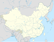
File:Republic of China edcp location map 1936 Heilungkiang.svg
Appearance

Size of this PNG preview of this SVG file: 512 × 399 pixels. Other resolutions: 308 × 240 pixels | 616 × 480 pixels | 986 × 768 pixels | 1,280 × 998 pixels | 2,560 × 1,995 pixels.
Original file (SVG file, nominally 512 × 399 pixels, file size: 7.75 MB)
File history
Click on a date/time to view the file as it appeared at that time.
| Date/Time | Thumbnail | Dimensions | User | Comment | |
|---|---|---|---|---|---|
| current | 05:42, 31 October 2024 |  | 512 × 399 (7.75 MB) | Lilauid | 更新 |
| 03:13, 30 August 2024 |  | 512 × 399 (7.11 MB) | Lilauid | {{Information |Description=東北新省方案之前的黑龍江省在中華民國的位置 |Source={{own}}<br />{{AttribSVG|Republic of China edcp location map 1936.svg}}<br />{{Adobe Illustrator}} |Date=2024-08-30 |Author=Lilauid |Permission= |other_versions={{Template:中華民國行政區劃地圖}}}} |
File usage
The following page uses this file:
Global file usage
The following other wikis use this file:
- Usage on zh.wikipedia.org


