
User:Imagico/Images
Maps
[edit]Africa river maps
[edit]These maps are all created using Generic Mapping Tools: http://gmt.soest.hawaii.edu/ and the VMAP0 data set for determining the watersheds.
-
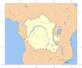 Congo and Lualaba
 -
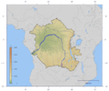 Congo and Lualaba with topography
 -
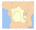 Congo and Lualaba with political borders
 -
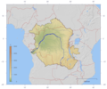 Congo and Lualaba with topography and political borders
 -
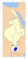 Nile
Nile -
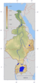 Nile with topography
 -
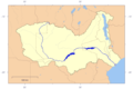
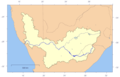 Orange River
 -
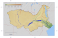
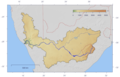 Orange River with topography
 -
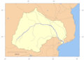 Limpopo River
 -
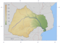 Limpopo River with topography
 -
 Zambezi River
 -
 Zambezi River with topography


Photos
[edit]-
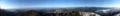 Panorama view from the Schauinsland